
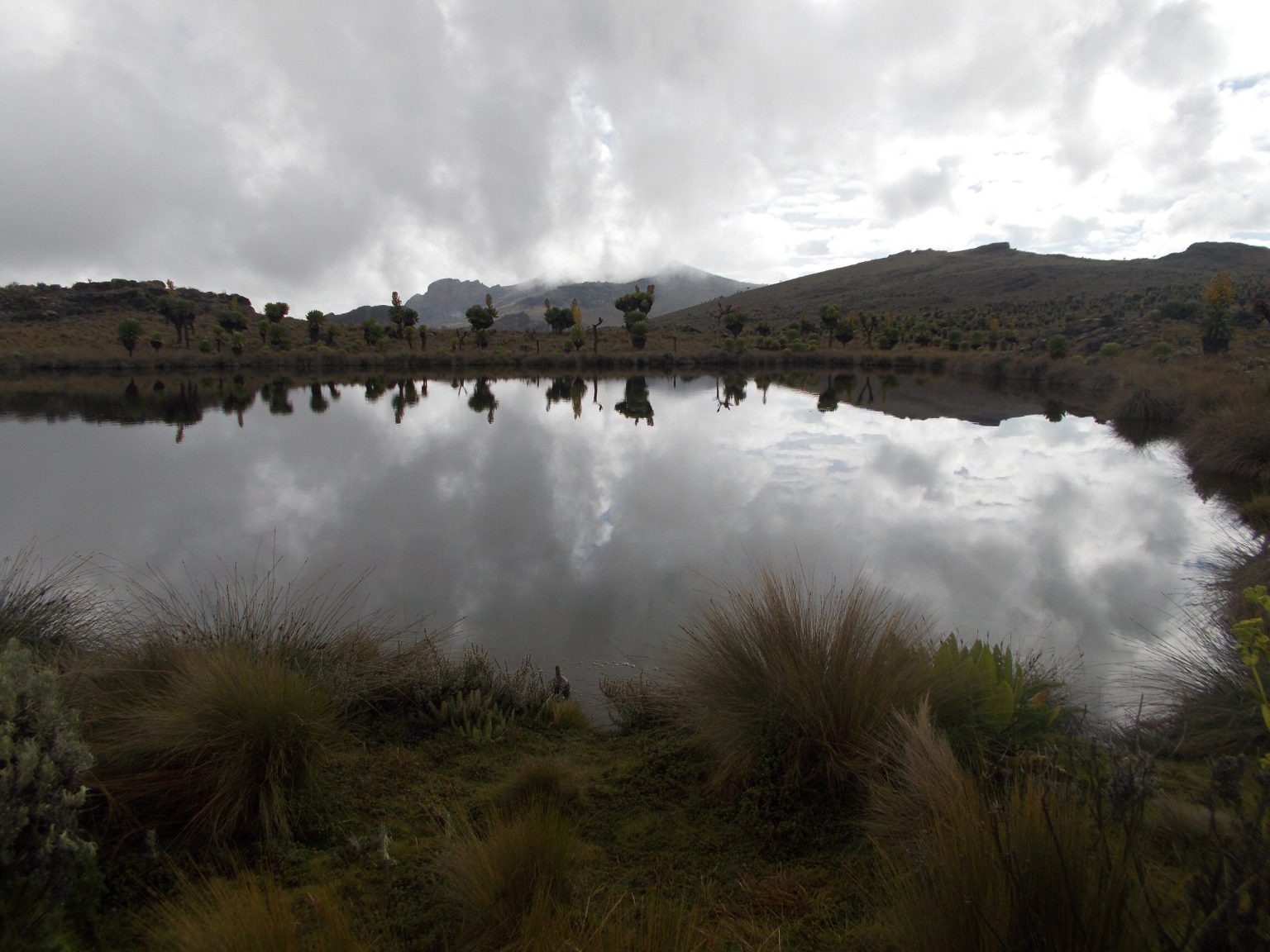
Mount Elgon trekking routes give hikers several ways to reach the upper mountain, with Sasa, Sipi, Piswa and Bushiyi covering different balances of steepness, time and trail character. Choose the route before arranging transport because each trailhead sits in a different part of the Elgon region. Mount Elgon is an extinct volcano on the Uganda and Kenya border, with Wagagai at 4,321 metres on the Uganda side.
Quick route choiceSasa suits hikers who want the most direct summit line. Sipi gives a longer and more gradual climb from the Kapkwai side. Piswa suits people who prefer a quieter northern ascent. Bushiyi can work for a shorter southern route, but access arrangements should be checked before travel.
Comparing the Main Mount Elgon Trekking Routes
The main Mount Elgon trekking routes are not interchangeable. The starting altitude, first day climb, number of walking days and road transfer all change with the trail. A route that looks shorter on paper can feel harder because height is gained quickly, while a longer route can give the legs more time to settle into the climb.
| Route | Common start | Typical plan | Best fit |
|---|---|---|---|
| Sasa | Budadiri | 3 to 4 days | Direct summit trek |
| Sipi | Kapkwai | 4 to 6 days | Gradual varied trek |
| Piswa | Kapkwata | 4 to 6 days | Gentler northern climb |
| Bushiyi | Bududa side | 3 to 4 days | Quieter short route |
Those durations are planning ranges rather than promises. A ranger, trekking provider and the condition of the group can change the camp pattern. Some hikers also climb one route and descend another, which changes both distance and vehicle planning.
Sasa Trail Mount Elgon Trek
The Sasa Trail Mount Elgon trek starts from Budadiri in the Sironko Valley and is the most direct established route to Wagagai in official Uganda Wildlife Authority material. The trail starts low, at roughly 1,250 metres, then gains a large amount of height on the first day. That first climb is the main reason Sasa has a harder reputation than its short duration suggests.
From the farming area above Budadiri, the route rises through forest and bamboo before reaching the higher moorland. Jackson’s Pool and the route toward Wagagai lie on the upper mountain. A standard Sasa plan can reach the summit and return in three days, but four days gives more breathing room and is the more comfortable plan described in official park material.
Sasa works well for a fit hiker with limited time. It is less suitable for someone who wants a slow first day. Knees can also take a beating on the descent if the same steep line is used both ways, which is why some groups prefer to climb Sasa and leave the mountain by another trail.
Sasa realityDo not mistake fewer days for an easy trek. The first day carries a big altitude gain, and wet clay can make the descent slower than expected. Trekking poles are useful here, especially after rain.
Sipi Trail Mount Elgon Trek
The Sipi Trail Mount Elgon trek begins from the Forest Exploration Centre at Kapkwai, at about 2,050 metres. It starts much higher than Budadiri, so the early climb is more gradual. The route crosses the north western side of the mountain and can pass Tutum Cave before entering the upper caldera area.
Several local trekking planners use four to six days for a Sipi summit plan, depending on camp choice and whether the route is combined with Sasa or Piswa. The longer walking schedule is part of its appeal. You spend more time moving through the changing vegetation rather than attacking a steep first day.
Sipi is a good fit for hikers who want a broader mountain trek and who are happy to spend extra nights camping. It also connects naturally with a stay around Sipi Falls before or after the high mountain section. The Sipi Falls village area and the Sipi mountain trail are related geographically, but the waterfall circuit is not the same hike as the summit route.
Piswa Trail Mount Elgon Trek
The Piswa Trail Mount Elgon trek starts from the Kapkwata side on the north of the mountain. It is widely described as a gentler route, with a more gradual climb than Sasa. Older route material gives a distance of about 49 kilometres for the main circuit, while present day itineraries vary because Piswa is often paired with another route.
The northern side gives wider views toward the plains and passes forest before reaching heath and moorland. The hot spring area can be included on longer upper mountain plans. Because the ascent is steadier, Piswa can suit hikers who would rather trade extra distance for a less abrupt first day.
The disadvantage is logistics. Kapkwata is not the same road transfer as Budadiri or Kapkwai. If the trek finishes on another side of the mountain, the vehicle and crew return plan needs to be agreed before the first step. This is easy to miss when booking a route by name alone.
Bushiyi Trail Mount Elgon Trek
The Bushiyi Trail Mount Elgon trek approaches from the Bududa side and now appears in local trekking itineraries as a quieter route to the upper mountain. An older Uganda Wildlife Authority brochure described Bushiyi as a proposed route, while present day operators sell it as an active option. That difference is a good reason to confirm the exact ranger post, trail condition and camp plan before booking.
Bushiyi is commonly planned over three or four days for a summit focused hike. It can appeal to strong walkers who want a shorter route without using Sasa. The trail is less discussed in general guidebooks, which also means there is less reliable public detail about day by day distance and camp names.
Choose Bushiyi because the route suits your group, not because it sounds secret. Ask who manages the hike, where the trek starts, what camp is used, how the crew is arranged and where you finish. A clear operational answer matters more than marketing language.
Suam Route and Northern Mount Elgon Trekking
The Suam Route on Mount Elgon is named in Uganda Wildlife Authority material as another northern option. It receives much less coverage than Sasa, Sipi and Piswa, and public planning information is thin. It should be treated as a route that requires direct confirmation rather than a default choice for a first visit.
Mount Elgon is a border mountain, so northern route planning can also raise questions about the Kenya side and transboundary trekking. Older park material notes that crossing arrangements can be made with ranger coordination. Do not assume that a normal Uganda trek automatically includes a border crossing. Immigration, ranger handover and current park rules need to be settled in advance.
For most first time hikers, Sasa, Sipi or Piswa will be easier to plan. Suam becomes more interesting for repeat visitors, specialist groups or people whose wider route already places them on the northern side.
Combining Mount Elgon Trekking Routes
A Mount Elgon route combination lets you climb one side and descend another. Common pairings include Sasa with Sipi and Sasa with Piswa. This avoids walking the same trail twice and gives a better sense of the mountain’s different slopes.
The trade off is transport. Your driver may drop you at Budadiri and collect you days later near Kapkwai or Kapkwata. Crew transport can also be needed at the end. A good itinerary states who pays for the crew return, where luggage not taken onto the mountain will be stored, and how the vehicle reaches the exit point.
Route combinations also change the rhythm of the trek. A steep Sasa ascent followed by a slower exit can work well for a fit group, while climbing a gentler route and descending Sasa can put more strain on knees. Think about the direction, not just the names of the two trails.
Plan the exit before the climbHikers often focus on the summit and forget that the vehicle may be on the wrong side of a very large mountain. Put the final trailhead, crew return and bag collection in writing before departure.
Choosing a Mount Elgon Trekking Route by Fitness
The best Mount Elgon trekking route depends on how your group handles steep climbs, long walking days, camping and altitude. Sasa can suit a strong walker who prefers a shorter schedule. Sipi works for people who want a more gradual line. Piswa is attractive when a gentler northern ascent matters more than saving time.
Fitness is only part of the decision. A person can be strong on flat ground and still struggle with several wet days, cold mornings or repeated descents. Forum reports about Ugandan mountain trips repeatedly praise waterproof outerwear and dry camp clothing because discomfort often comes from being wet rather than from a single steep section.
If two people in the same group have very different ability, choose for the slower hiker. There is little value in saving one day if someone spends the whole trek trying to catch up. A longer plan can also leave more room for weather delays and slower movement above 4,000 metres.
Guides, Porters and Camps on Mount Elgon Routes
Uganda Wildlife Authority guidance states that a trained ranger guide is required on treks in the park. Mount Elgon porters can carry group equipment and personal loads, while cooks and camp staff may be included by a trekking provider. The exact crew depends on how the trip is booked.
Ask what you carry yourself. A day pack should normally stay with you for water, rain gear, a warm layer, food for the trail and personal items. The larger bag can travel with a porter if that service is arranged. Keep medicines, valuables and one dry layer in the day pack rather than placing every important item in the porter bag.
Camps are simple mountain camps rather than lodge stops. A dry sleeping bag, insulation from the ground and a change of clothes for camp make a large difference after a wet day. Hiker reports also show that first time campers often underestimate how much colder a night feels when clothing and boots are damp.
Weather and Trail Conditions on Mount Elgon Routes
Mount Elgon trail conditions can change within hours. The mountain sits close to the equator, but altitude creates cold, mist, rain and wind on the upper slopes. The drier periods around June to August and December to early March are commonly preferred for trekking, yet rain is possible in any month.
Sasa becomes more demanding when the steep lower trail is muddy. Sipi and Piswa can still be wet over longer sections because a gradual route means more time outside. Bushiyi access roads and trail conditions deserve a fresh check before departure because less information is published about them.
Start each day ready for a weather change. Put waterproofs where they can be reached without unpacking the whole bag. A rain cover helps, but a waterproof liner or dry bags inside the pack are more dependable for sleep clothing and electronics.
Getting to the Mount Elgon Trailheads
Most Uganda side Mount Elgon trekking trips use Mbale as the main city base before the trail. Budadiri serves the Sasa side, Kapkwai serves the Sipi route, Kapkwata serves Piswa, and Bushiyi lies toward Bududa. These are different road transfers, so a booking should name the trailhead rather than simply say Mount Elgon.
Mbale works well for a night before an early start because supplies, road transport and a proper bed are easier to arrange there. It is also useful after the trek when the group wants a shower, restaurant meal and recovery before continuing to Kampala, Sipi Falls or another part of Uganda.
Road time should include a margin for rain and local traffic. Mountain access roads can be slower than the map suggests. Arriving at the ranger post early gives the team time to check loads and sort permits without turning the first walking day into a race against darkness.
Mount Elgon Trekking Routes FAQ
Which Mount Elgon trekking route is easiest? Piswa is usually described as one of the gentler summit approaches because it gains height more gradually. Sipi also starts higher than Sasa. Easy is relative on a trek above 4,000 metres, so weather, fitness and the number of days still matter.
Which Mount Elgon trekking route is shortest? Sasa is the most direct established route in Uganda Wildlife Authority material. A summit and return can be planned in three days, while four days gives a less rushed schedule.
Can I climb one Mount Elgon route and descend another? Yes. Sasa can be paired with Sipi or Piswa, among other combinations. Confirm the exit vehicle, crew return and luggage plan before departure because the trailheads are far apart by road.
Do I need a guide on Mount Elgon? Uganda Wildlife Authority guidance requires a trained ranger guide for park treks. Many visitors also arrange porters and a cook through a licensed trekking provider.
How much is Mount Elgon park entry? Uganda Wildlife Authority currently displays USD 35 for foreign non residents, USD 25 for foreign residents and UGX 20,000 for East African visitors on its Mount Elgon page. Trekking support and other services may carry separate charges. Confirm the full amount with UWA before payment.
Which route is best for a first Mount Elgon trek? Sasa is straightforward to understand but steep at the start. Sipi gives a more gradual plan with extra time on the mountain. Piswa can suit hikers who prefer a gentler northern route. The best first route is the one that matches your walking pace and available days.
Is Bushiyi Trail open? Present day trekking companies offer Bushiyi itineraries, while older official material described the route as proposed. Confirm present access, ranger arrangements and camp details with Uganda Wildlife Authority or a licensed provider before building a trip around it.
Mount Elgon Hotel & Spa in Mbale is a practical base before or after a Mount Elgon trek. Book your room, dining or spa time around the confirmed trailhead and trekking dates, then use Mbale for the final road transfer to the mountain.