
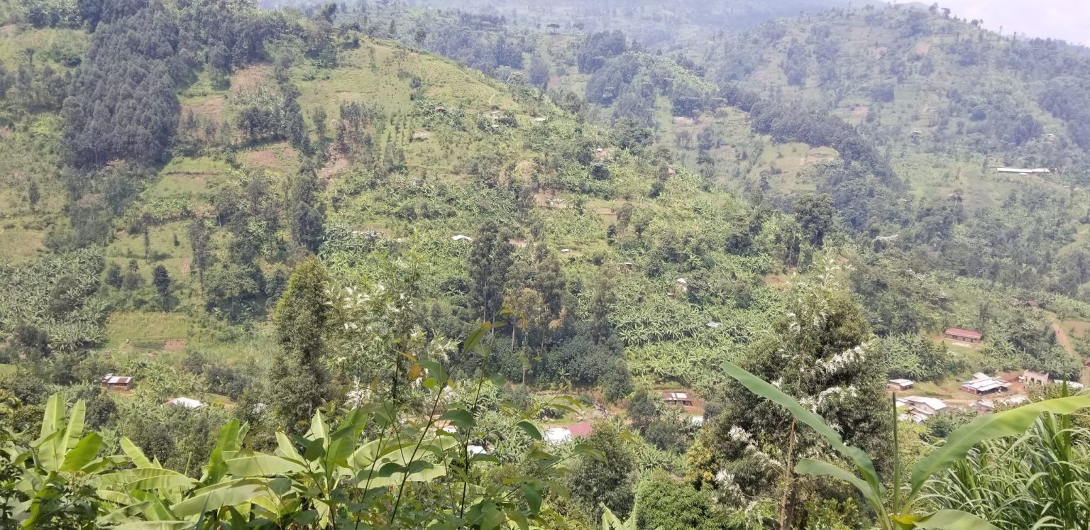
The Sasa Route is the most direct established trekking route from the Uganda side of Mount Elgon to Wagagai Peak, and it suits fit hikers who prefer a shorter summit plan. Most Sasa trekking trips start from Budadiri and spend several days moving from cultivated lower slopes into forest, bamboo and high moorland. The route reaches Mount Elgon’s 4,321 metre summit without technical climbing.
Quick route readChoose Sasa if you are comfortable with a hard first day, simple mountain camps and a faster gain in altitude. Choose a gentler route if your priority is a slower start rather than fewer trekking days.
Sasa Route Trekking Overview
The Sasa Route begins near Budadiri in the Sironko Valley on the western side of Mount Elgon. Uganda Wildlife Authority material describes it as the shortest and most direct established route to the summit from Uganda. That description is useful, but it can mislead a first time hiker. Short does not mean easy.
The lower trail starts at roughly 1,250 metres. The first walking day gains a large amount of height, with official park material putting the rise at about 1,650 metres before the route settles into higher forest and bamboo. This makes the opening day the physical test that defines Sasa.
A normal Sasa summit trek can be planned over three or four days. Some trekking companies stretch it to five days when the group wants more time on the upper mountain or plans to leave by another route. The exact camp sequence can change with pace, weather and ranger advice.
Wagagai is the usual summit target. The climb does not require ropes, harnesses or technical mountaineering skill on the standard trekking line. Fitness, wet trail conditions, cold nights and altitude are the main issues.
Starting the Sasa Trek from Budadiri
Budadiri is the main access town for the Sasa trek. It lies north east of Mbale and is reached by road through the foothills. A trekking booking should state Budadiri or the exact ranger post as the trailhead, rather than using the broad phrase Mount Elgon pickup. The mountain has several access points and they are not close to each other by road.
The early section passes through settled farming country before the park boundary. Coffee, bananas and small farms occupy much of the lower slope. Walking here gives the route a very different opening from Piswa or Sipi, where the trail begins higher.
Start early. The first day is long enough without losing morning time to luggage sorting, permit checks or a late road transfer. Hikers who sleep in Mbale the previous night can arrange an early departure, eat breakfast and reach the Budadiri side before the day becomes hot.
At the start, keep rain gear, drinking water, snacks and one warm layer in your own day pack. A porter can carry the larger bag when that service is arranged, but the items needed during the walking day should stay with you.
The First Day of the Sasa Trek
The first day is why Sasa has a harder reputation than its total duration suggests. Height comes quickly. The trail rises through farmed slopes and then into the park, where the Mudangi Cliffs create one of the better known sections of the route.
Older park material calls this cliff section the Mudangi or Muddange area. Steps and fixed aids have been used on the steep ground, but rain still changes the feel of the climb. Wet soil can become slick, and the same slope can take much longer on a descent than it did on a dry ascent.
Do not race the first climb. A strong walker can still pay for an aggressive pace later when the air becomes thinner. Take small drinks often, eat before you feel empty and let the guide set a rhythm that the slowest person can maintain.
Traveller reports about Sasa repeatedly mention the contrast between the physical first day and the more open walking higher up. They also mention sore knees after a steep return. Trekking poles are useful, particularly if rain falls during the descent.
The mistake to avoidSaving a trekking day is not useful if the first climb leaves the group exhausted. If your fitness is uncertain, a four day Sasa plan is usually more sensible than forcing the shortest possible schedule.
Forest and Bamboo Hiking on the Sasa Route
After the steep lower climb, the route moves through Mount Elgon’s changing vegetation zones. Montane forest gives way to bamboo, then higher heath and moorland. The transition is one of the clearest ways to feel the altitude changing because the plants and temperature alter as the trail rises.
The bamboo zone can be wet underfoot. Even in a drier travel period, water can sit on shaded ground and rain may arrive without much warning. Boots with reliable grip matter more here than fashionable trekking footwear. A boot that fits badly will become a problem once the feet swell after several hours of climbing.
Keep dry camp clothing sealed inside the larger bag. A waterproof pack cover helps, but water can still work in around seams. A simple inner liner or separate dry bags for sleeping clothes are more dependable.
The forest also gives way to more exposed terrain. Wind becomes more noticeable and the temperature drops, especially late in the day. Put the warm layer where it can be reached before camp rather than burying it beneath everything else.
Mude Cave and Upper Sasa Trekking Camps
Mude Cave Camp is commonly used as a high camp on Sasa itineraries. It sits above the main forest zones and places hikers within reach of the summit section. Camp plans vary, so treat a named camp on an online itinerary as a likely plan rather than a guarantee.
Camps on Mount Elgon are simple. Expect tents or basic shelter arrangements, limited washing facilities and cold evenings. This is not a lodge to lodge trek. Sleeping comfort comes mainly from the gear carried up the mountain.
A warm sleeping bag and an insulating mat make a large difference. Traveller accounts often focus less on the climbing than on cold nights, damp clothing and how basic a mountain camp feels to someone who normally stays in hotels.
Keep one set of clothing for camp only. Put it on after walking, then protect it from rain and morning dew. Starting the next day in dry socks and a dry base layer feels much better than trying to sleep in clothing that has already spent hours on a wet trail.
Summit Hiking from the Sasa Route
The summit section heads toward Wagagai, Mount Elgon’s highest point at 4,321 metres. The upper mountain is more open than the lower Sasa climb, with moorland, volcanic forms and broad views when cloud lifts. The walking is not technically hard, but altitude slows many people.
Above 4,000 metres, a pace that felt easy lower down can become tiring. Short rests help. So does accepting that another hiker may walk faster. There is no prize for reaching the summit first.
Some itineraries pass near Jackson’s Pool and the upper volcanic features before or after the summit push. The exact line depends on the camp and route combination. Ask the guide what is planned rather than assuming every Sasa itinerary visits every named feature on Mount Elgon.
Cloud and rain can hide views quickly. The summit is still the summit when visibility is poor. Plan clothing for cold wind and moisture, then treat clear weather as a bonus rather than something a trekking company can promise.
Sasa Route Hiking Difficulty
Sasa is best described as a demanding walking route rather than a technical climb. The lower day is steep, the trek reaches high altitude and the group sleeps in basic mountain camps. None of those requires mountaineering skill, but together they make the trip harder than a normal day hike.
Regular walking fitness is a good starting point. Before travel, practise climbing hills or stairs for several hours while carrying the day pack you plan to use. Back to back walking days are better preparation than one hard gym session each week.
Knees deserve attention. A steep descent can be harder than the ascent for people with weak knees or poor balance. Poles, slower steps and a route that exits by a gentler trail can reduce some of that strain.
Altitude is the other variable. A person can be very fit and still feel headache, poor appetite or unusual tiredness high on the mountain. Tell the guide when symptoms appear. Hiding them to keep up with friends is a bad decision.
Combining Sasa Trekking with Piswa or Sipi
A Sasa trek does not have to return by the same trail. Some groups climb from Budadiri and descend through Piswa or Sipi. This changes the trip from a simple out and back plan into a crossing of different sides of the mountain.
The benefit is variety. You avoid repeating the steep lower Sasa descent and see another vegetation sequence and access area. The cost is logistical complexity, because the vehicle may need to collect the group many kilometres away by road.
Agree on the exit before starting. Write down the final ranger post, vehicle meeting point, luggage plan and how crew members return. This small planning detail prevents a common problem where the hikers finish on one side while their transport is waiting on another.
For a first Mount Elgon trek, combining routes can be more interesting than walking Sasa both ways. It is still sensible to choose the combination for walking ability, not because a longer itinerary looks better on paper.
Plan the final road transfer nowSasa, Sipi and Piswa use different trailheads. A route combination is only complete when the exit vehicle and stored luggage have a clear plan.
Weather for a Sasa Hiking Trip
Mount Elgon can receive rain at any time. Drier periods are often preferred for summit trekking because steep clay and forest ground are easier when they have had time to drain. Rain still belongs in the packing plan no matter which month you choose.
Sasa reacts strongly to wet weather because of its steep lower section. A short shower can turn exposed soil slippery. Fog can reduce visibility higher up, and cold wind near the summit can arrive after a warm start below.
Carry waterproof outer clothing rather than a light town jacket. Protect the phone and any camera in a dry bag. At camp, change before the body gets cold and keep the wet walking layer away from the sleeping bag.
Weather also affects road access. Give the transfer from Mbale or Budadiri enough time, especially after heavy rain. Starting late because the road was slower than expected puts pressure on the entire first day.
Preparing for Your Sasa Trek
Preparation for Sasa is fairly simple. Build walking fitness, test your boots, learn how the day pack feels when loaded, and arrive with clothing for rain and cold. The dedicated Mount Elgon packing guide can handle the full gear list, while the main hiking guide can help with wider route choice.
Ask the trekking provider what is included. Ranger services, porter loads, tents, sleeping gear, meals and transport can be packaged in different ways. Never assume an item is included because another company includes it.
Leave some flexibility after the trek. A shower, proper meal and quiet night in Mbale are useful after several days in camp. Adding a hard road transfer immediately after the final descent can make the last day unnecessarily tiring.
If Sasa looks too aggressive once you compare the routes, change it. Piswa and Sipi exist for a reason. The best route is the one you can complete safely and still enjoy walking.
Sasa Route Guide FAQ
How many days does the Sasa Route take? A Sasa summit trek is commonly planned over three or four days, with some itineraries using five days when more time is wanted on the upper mountain or another route is used for the descent.
Is the Sasa Route suitable for beginners? A fit beginner can complete Sasa with a sensible pace and guide, but the first day is steep. Beginners who prefer a slower gain in height may find Piswa or Sipi more comfortable.
Do I need technical climbing skill for Sasa? No. The normal Sasa line to Wagagai is a trekking route rather than a technical mountaineering climb. Good walking fitness, weather protection and comfort with basic camping matter more.
Can I descend by a different Mount Elgon route? Yes. Sasa can be combined with Piswa or Sipi. Confirm the exit vehicle and luggage plan before departure because the final trailhead can be far from Budadiri by road.
How much is Mount Elgon park entry? Uganda Wildlife Authority currently displays USD 35 for foreign non residents, USD 25 for foreign residents and UGX 20,000 for East African visitors on its Mount Elgon page. Trekking and support services can have separate charges, so confirm the full amount before payment.
Where should I stay before a Sasa trek? Mbale works well for travellers who want a full hotel night before the road transfer to Budadiri. Staying closer to Budadiri can also suit an early trail start. Choose based on the pickup plan agreed with your guide.
Mount Elgon Hotel & Spa can be used as a Mbale base before or after a Sasa trek, with rooms, dining and spa facilities available around your confirmed mountain dates. Contact the hotel once the Budadiri start and return plan are fixed.